Features
10 Liverpool City Region walks perfect for your weekend
5 years ago
Many of us have now got a pair of trusty walking shoes to make sure we get out and about on our daily exercise, so make the most of them with these 10 top Liverpool walks across the city region.
You might not be able to do some of these Liverpool walks now – government restrictions and all – but you can venture on the ones you can and save the others for later…
Speke

Enjoy views of the Wirral peninsula and North Wales, birdlife in the estuary and a unique view of planes taking off from Liverpool Airport, with the Garston Coastal Reserve Trail recommended by the National Trust. Start at Speke Hall behind the children’s play area, then walk through the Home Farm courtyard and go straight ahead, past the children’s play area. You’ll see two paths ahead of you – go through the hedge for the Coastal Reserve walk.
Follow the path until you reach a metal gate and continue on the boardwalk until you get to the concrete taxiway. Follow the red line along the taxiway until you reach a stone path. Walk down this path – don’t forget to look left towards the river – and head along the top of the cliff for 400 yards towards the yacht club (the building that looks like a sail). The path forks into two at this point – and you can take the short version of the walk down the left-hand fork which will lead you around the yacht club in a circle and then you can retrace your route back down the taxiway.
If you want to make it longer, follow the arrow on the red marker post just after the yacht club. This will lead you down a single-track stone path and through a gap in the fence. Continue along the path and turn right at the T-junction, onto a footpath up and around the Bund, ending up back at Home Farm.
Port Sunlight

The model village built by Lever Brothers to accommodate workers in its soap factory in 1888 has got loads of Grade I listed buildings. In the centre of the village you can enjoy a walk along George’s Drive which has fountains, a lake, gardens and an impressive war memorial.
You can start your walk from one of the car parks on Jubilee Crescent, then head north to the Lady Lever art gallery, passing through the gardens where you’ll find the war memorial and the Diamond Jubilee Sundial.
And, after exploring the village you can head east to the riverside park, which has surfaced footpaths with a small lake, the River Dibbin and great views across the Mersey towards Liverpool.
North West Wirral
Irby & Thurstaston – 3.5 miles with option to extend route by further 2 miles

This is a circular walk around the outskirts of Irby and the edge of Thurstaston Common, with an option to take in part of Arrowe Country Park.
The fitter of us can probably complete it in around two hours, so it’s a good stretch of the legs.
It starts at Thingwall Road, and takes you through Harrock Wood – owned by the National Trust – through Irby Village and Thurstaston Common and back to Thingwall Road, passing some charming places along the way. You can get a map and detailed directions from Visit Wirral.
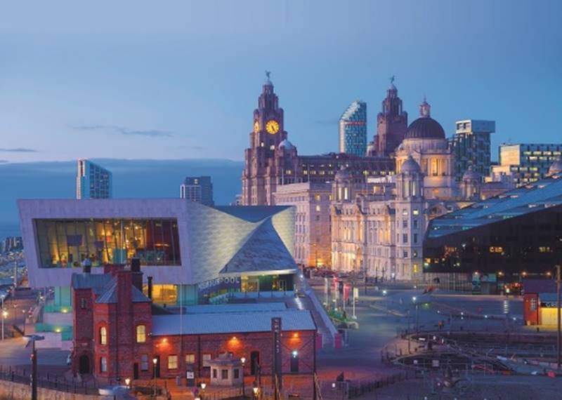
Liverpool – North from the Pier Head

Start by the Cunard Building in the middle of The Three Graces. Walk across to the ferry terminal opposite, turn right and head north along the waterfront past the landing stage. Stop and have a look at the Memorial to the Heroes of the Engine Room. Then follow Prince’s Parade along the river with Prince’s Dock on your right. Go on to the very end then return on the other side of the dock.
Walk onto the white footbridge which was designed by an architecture student and won a design competition in 2001. The bridge resembles the ribcage of a whale and is a reminder that whaling ships once sailed out of Liverpool. Continue past the Malmaison Hotel and back to the Pier Head. “Just one mile but a good, invigorating riverside short walk for a winter’s day,” says Pat Sullivan, chair of Liverpool Ramblers.
Thornton and Little Crosby
This is a four and a half mile walk that takes you through one of the oldest villages in Sefton, Thornton, starting at the Grade II listed stocks and sundial at the junction of Water Lane and Green Street which date back to the late 18th century.
The walk takes you towards Ince Blundell Park, past Crosby Hall, through Little Crosby and back to Thornton.
Highlights in the walk include the Lion Lodge Gates in Ince lane, St Mary’s Church which houses the works of the late artist and sculptor Nicholas Blundell and the Well Cross on Little Crosby’s old village green.
You can get a map and full details of the walk from Visit Sefton and West Lancs More info here.
The Maghull Trail
This is a fairly level walking route for miles, past several sites of local history interest, including the churchyard where Maghull’s most famous former resident, Frank Hornby, is buried.
From Maghull Station turn right along Station Road and left after 200 metres onto Rutherford Road, to get to the Leeds–Liverpool Canal at Drapers Bridge, then go left along the towpath, towards Melling. At Melling Stone Bridge leave the towpath via a track to reach Brewery Lane where a footpath continues through open fields, as the driveway to Wood Hall Farm.
Follow the footpath towards the duck pond and left through the farmyard, towards the railway embankment. Walk through an underpass to turn left between the M58 and the railway and cross the motorway footbridge. Take the enclosed footpath under a link road of the motorway and follow the footpath alongside Melling Brook to reach Dunnings Bridge Road.
Cross to pick up the footpath opposite. Passing underneath the disused Cheshire Lines railway bridge, follow the embankment of the Alt to Mill Dam Bridge. Continue over the bridge and through Jubilee Woods and, after 500 metres, you’ll meet the trackbed of the disused Cheshire Lines railway again and, crossing Dover’s Brook, continue along the banks of Whinny Brook, passing the Meadows pub.
Cross the road towards Maghull Town Hall and turn left along Liverpool Road South to the children’s playground. Go through the public gardens and follow the path alongside the tennis courts, turn right to reach the A59 Northway via the steps, left at the top and after 100 metres a footpath sign marks steps down to the canal towpath.
Turn right to come to St. Andrew’s Church built in 1878, on the other side of the canal. A marble memorial to Frank Hornby MP, of Hornby Dublo, Dinky Toys and Meccano fame, stands in the graveyard by the chapel. Carry on along towpath to Maghull Hall Swing Bridge, then back to Drapers Bridge to complete the circuit.
Liverpool City Walk

Around 3.2 miles and starting at the front of Lime Street Station, you can walk through some of the city’s most well-known attractions, and some less well known. Turn left until you get to the Britannia Adelphi Hotel, then turn left up Brownlow Hill. Continue up Brownlow Hill and cross to the right when your reach the back of the Metropolitan Cathedral.
Cross over at the front of the cathedral and go along Hope Street to the Philharmonic Hall, then carry on until you get to the Luggage sculpture. Continue along Hope Street then turn left into Canning Street. At the junction with Bedford Street South, go down Bedford Street South and at Upper Parliament Street, turn right again and cross over at the traffic lights at the junction with Princes Road.
Continue along Upper Parliament Street then cross over and turn right into St James Road, leading to Liverpool Cathedral.
Leave the Cathedral and go down Upper Duke Street to the junction with Berry Street and Great George Street. Cross over to the Chinese arch at the top of Nelson Street.
Continue down Nelson Street, through Chinatown. Turn right onto St James Street and then Park Lane, towards Paradise Street. Turn left to go to Albert Dock.
St Helens – Billinge Hill

Climb to the highest point on Merseyside and enjoy fantastic views as far as Snowdonia in Wales on this walk in St Helens. The walk starts in Longshaw where there is a footpath into the woods of the Billinge Plantation, just off Crank Road. Follow the woodland trails south and you will gradually ascend to the hill summit on the other side of the plantation.
The hill is 587 ft tall, with great views towards Great Orme in Wales, Blackpool tower, Greater Manchester, Winter Hill and the Derbyshire Peak District. You’ll also see a beacon tower at the summit and several large transmitter masts nearby. After taking in the views the route descends to the woods and returns to the start point.
To extend your walk you could head north and visit the two reservoirs at Orrell Water Park, or pick up the Leeds and Liverpool Canal.
Knowsley Village
Knowsley Council has some great heritage walks you can go on in the area, including this of Knowsley Village, steeped in history (more of which you can find on the council website) and others like Kirkby and Huyton. They take between 30-60 minutes, longer if you linger at all the historical and fascinating points of interest.
Start at The Derby Arms and pass the Old Post Office to the almshouses, originally named Countess Mary’s Bungalows, built in 1883 for retired estate workers. You’ll see the Grade II listed church of St. Mary the Virgin, built in 1844, with the Derby Memorial Chapel added in 1871.
Wander around the picturesque village green, also known as Maypole Green, and you can see a variety of buildings including the village hall and the Memorial Cross commemorating the men lost in the First World War. Along School Lane are some of the oldest buildings in the village, including Maypole Farm, which dates from 1772.
Walking along Tithebarn Road and you’ll see Knowsley Vicarage, built around 1885 and Grade II listed.
Halton – Widnes, The Bongs
Halton Council has put together six green space walks in Runcorn and Widnes, including this three-mile route which should take you about 45-50 minutes. From the car park on Halton View Road, turn left through the gates then right at the T junction. Taking your 1st left path at the fork, continue along keeping to the right-hand pathway until you exit onto Bishops Way. Walk along the left-hand side of Bishops Way until you arrive at a roundabout, and take the 2nd left onto Dykin Road.
At the end of Dykin Road turn left onto Barrow’s Green Lane and cross onto the right-hand side, then take your next right into Sunnybank and walk along bearing right onto pathway. At the gates take the left-hand pathway and continue walking until you arrive at a small pond, bear left at the pond then take 1st right path to come back on yourself. At the fork in the pathway bear left and continue walking, taking your 1st right turn then immediately left to follow the pathway along until your reach the end of Weates Close.
Turn left onto Warrington Road and carefully cross over to your right at the roundabout, continue along Warrington Road bearing right onto Halton View Road to walk back to where you started.


 Subscribe
 Follow Us
 Follow Us
 Follow Us
 Follow Us
 Follow Us